Show Mobile Navigation
Powered by Blogger.
Travel
Showing posts with label Travel. Show all posts

Friday, October 24, 2014

Psychedelic Stalactite Formation at Avshalom Cave, Israel

XPlanet - 10/24/2014 08:49:00 PM
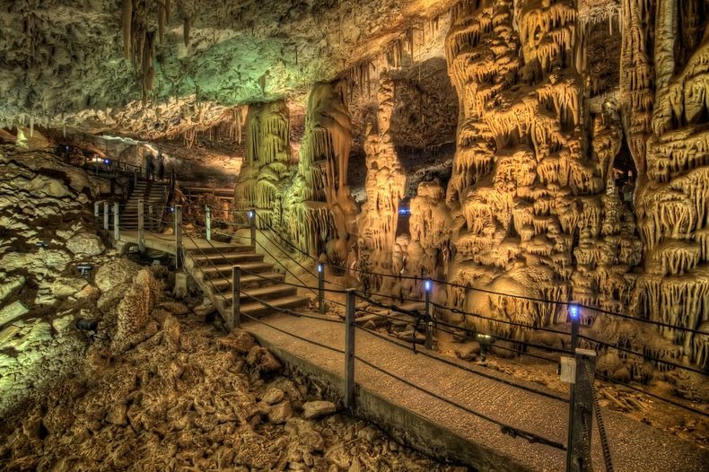
Avshalom Cave also known as Soreq Cave or Stalactites Cave is located on the western slopes of the Judean mountains near Bet Shemesh in Israel. The 5000 square meters cave has one of the most impressive collection of stalactites and stalagmites formed in a variety of patterns. Some of the stalactites hanging from the ceiling of the cave are up to four meters long, and in some cases they fuse with stalagmites growing from the floor. Other formations resemble shelves or sheets of cloth, branches, corals and clusters of grapes, among many other objects. The bizarre patterns at Avshalom Cave combined with the ghostly lightening creates a rather creepy ambience inside the cave.

Stalactites and stalagmites are formed by water flowing from the ceiling to the floor of the cave, melting limestone on the way. Over hundreds of thousands of years, each drop of mineral-laden water deposited a thin layer of calcite on the ceiling and on the ground. Given enough time these tiny layers add up to form columns of calcium carbonate called stalactites and stalagmites.

avshalom-cave-0

The Avshalom Cave was discovered by accident in May 1968 when an explosion opened a crack to reveal the magical and fantastic cave hidden beneath. According to geologists, the Soreq cave was formed around 25 million-years ago, when the mountainous range of the Judean Hills rose up above the surface of the water. The layers of limestone and dolomite rock were displaced and folded with time, forming cracks which allowed water to enter and dissolve some of the rock. While seeping through the cracks and flowing through the soil this water absorbed increasing amounts of carbon dioxide from the roots of the plants and the surrounding decay. This process that turns the water acidic is called “Karst” and helped with the cave expansion process.

Years later, when the sea retreated and lowered the ground water level, the dissolution of rock stopped and the process was reversed. Drops of water saturated with limestone solution reached the ceiling of the cave the carbon dioxide escaped and the remaining limestone crystallized, creating the huge diversity of stalactites we see today. In several still-active areas of the cave, which maintains constant heat and humidity year-round, the stalactites and stalagmites continue to grow.

The cave is named after Avshalom Shoham, an Israeli soldier killed in the War of Attrition. After its discovery, the location of the cave was kept a secret for several years for fear of damage to its natural treasures. The cave which is in the heart of the 67-dunam Avshalom Nature Reserve, declared in 1975, is today open year round to visitors.

avshalom-cave-1
avshalom-cave-2
avshalom-cave-3
avshalom-cave-4
avshalom-cave-5
avshalom-cave-6
avshalom-cave-7
avshalom-cave-8

Dean's Blue Hole, World's Deepest Blue Hole

XPlanet - 10/24/2014 08:46:00 PM
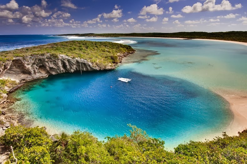
Dean's Blue Hole near Clarence Town on Long Island, Bahamas, is the world's deepest known “blue hole” - a term given to any deep, water filled, vertical caves or sinkholes with an entrance below the water surface. While most blue holes and sinkholes reach a maximum depth of 110 meters, Dean's Blue Hole plunges to more than 200 meters, which makes it quite exceptional. At the surface, Dean's Blue Hole is roughly circular, with a diameter ranging from 25 to 35 meters. After descending 20 meters, the hole widens considerably into a cavern with a diameter of 100 meters.

deans-blue-hole-9

Blue holes are so called for the dramatic contrast between the dark blue, deep waters of their depths and the lighter blue of the shallows around them. The intense blue color is created by high transparency of water and bright white carbonate sand. Blue light is the most enduring part of the spectrum; other parts of the spectrum - red, yellow, and green - are absorbed during their path through water, blue light manages to reach the white sand and return upon reflection.

Blue holes formed during past ice ages, when sea level was as much as 100–120 meters lower than at present. These holes were formed by deeper groundwater gradually dissolving the limestone until the ceiling of these voids collapsed. Later the sea level rose and filled the holes with water.
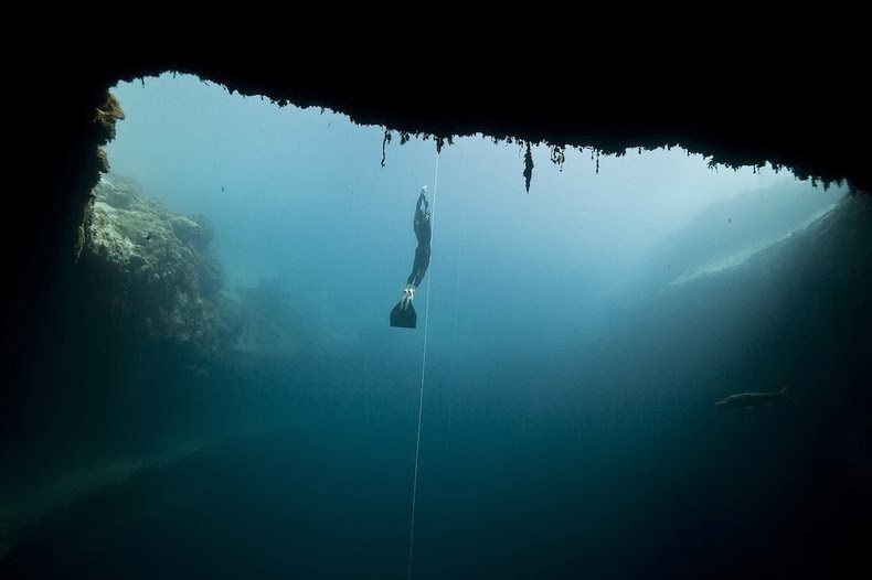
Dean's Blue Hole is a popular spot for diving ad snorkeling. At the 2012 freediving world cup in the Bahamas, New Zealand competitor William Trubridge set a world record when he dived to a depth of 121 meters without air in Dean’s Blue Hole.

deans-blue-hole-8
deans-blue-hole-3
deans-blue-hole-4
deans-blue-hole-1
deans-blue-hole-2
deans-blue-hole-6
deans-blue-hole-7
deans-blue-hole-5

Colorful Rolling Grasslands of Palouse

XPlanet - 10/24/2014 08:35:00 PM
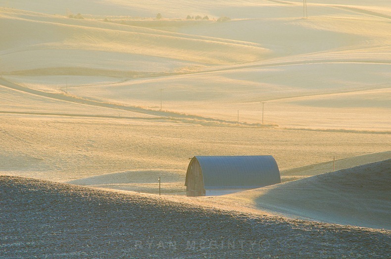
The Palouse is a region of the northwestern United States, encompassing parts of southeastern Washington, north central Idaho and, in some definitions, extending south into northeast Oregon. Located just south of Spokane, the Palouse is a rich farming area of some 3,000 square miles primarily producing wheat and legumes. This area is characterized by beautiful rolling hills, lush green dunes and rich deep soil. For photographers, the Palouse is an exciting area to explore, in large measure because it is comparatively unknown.

The peculiar and picturesque silt dunes of the Palouse Prairie were formed thousands of years ago during the ice ages. Blown in from the glacial outwash plains to the west and south, the Palouse hills consist of more or less random humps and hollows. The steepest slopes may reach 50% slope while the lowest low ranges from 5 to 130 cm deep. Large areas of level land are rare.

The vast expanses of the rolling Palouse hills were once covered with native grassland before European settlers moved into the area and began intensive farming. Unlike some other North American grasslands, such as the short grass prairies of the Great Plains and tall grass prairies of the Midwest, neither fires nor extensive grazing by large herbivores were historically a part of the Palouse grassland ecology. When European settlers moved into the Palouse at the end of the nineteenth century, they brought both fire and grazers. These two influences had a huge impact on the native plants.

palouse-16

Now the majority of the Palouse prairie is farmland and towns. It is estimated that less than 1% of the native Palouse vegetation remains making the Palouse prairie one of the most endangered ecosystems. Evidence of the Palouse prairie’s wild and diverse vegetation still exist along the roads, railroad tracks, corners of fields and lots, in pastures, along streams, open areas of pine forests and steep or rocky hills.

These amazing photos of the Palouse were taken by Ryan McGinty.

Palouse Camouflage
Palouse Colors
Palouse Mist
Palouse Afternoon Layer Cake
palouse-13
palouse-14
palouse-15
palouse-17
palouse-18
The following collection of photos were taken by Chris Froelich
palouse-8
palouse-9
palouse-10
palouse-11
palouse-12
Sources: 1234

Intriguing Biodiversity at El Angel Ecological Reserve in Ecuador

XPlanet - 10/24/2014 08:31:00 PM
El Angel is a small village located in the province of Carchi, in Ecuador, approximately 170 km north of Quito and situated on the border with Colombia. The village is located in a unique type of high altitude, humid moorland called “paramo” characteristically found in the Andes of northern Ecuador and southern Colombia. The El Angel Ecological Reserve lies at nearly 12,000 to 15,600 feet above sea level and covers an area of 15,700 hectares of the paramo.

A diverse range of plants grow in this region, 60% of which are found nowhere else in the world. The most notable among them is frailejones (Espeletia pychnophyla) a giant member of the daisy family, endemic to the area. The frailejon is a treelike shrub with broad, gray-white, hairy leaves and yellow flowers, which may reach a height of up to six feet over the course of its lifetime. They cover 85% of the reserve, lending the paramo of El Angel its striking appearance and gray-green color.

el-angel-paramo-7

The Paramo of El Angel remains frigid throughout the year even though it is only 80 km from the equator. In summer months (June - September), days can be warm - up to 18 ° C, but in the winter even in daytime the temperature is around 0° C. Due to the cold weather organic remnants in paramos do not decompose - they accumulate. The moist climate turns this all into a giant natural sponge, trapping moisture deposited by the regular rains and mists and letting it out slowly into the surrounding foothills in the form of streams and small rivers, which eventually join to make up the basin of the Mira and El Angel rivers.

Plants growing in the paramo have developed specific methods to protect themselves from the cold. One method is growing in rosettes, so the wind can not chill the centre of the plant. Many plants have developed very soft, "plumy" leaves and flowers which serve as mini-sponges. In some plants the old leaves do not fall off - they enclose the stem and allow development of new roots along the stem.
The reserve is also home to numerous animals including highlights, rainbow trout, the frog marsupial, the jambato, duck dotted, the condor, gli-gli coot, moor Partridge, the curiquingues, the Andean gull, the giant heath, the Quilico, deer, dirty, wild rabbits, the Chucuri, the brocket, the fox, the buzzer and the turtle and other species.

el-angel-paramo-11
el-angel-paramo-3
el-angel-paramo-4
el-angel-paramo-5
el-angel-paramo-9
el-angel-paramo-1
el-angel-paramo-2
el-angel-paramo-6
el-angel-paramo-10

Zlatni Rat - The Golden Horn Beach, Croatia

Unknown - 10/24/2014 06:37:00 PM
The Golden Horn, also called Zlatni Rat, is the most spectacular of Croatia's beaches. This vast, golden pebble beach, almost 580 yards long, juts out into the water like a white tongue stretched into the sea. The tip of the beach changes shape and position, depending on the wind. Surrounded by pine wood and crystal clear sea, this beach stands out with its fascinating beauty.

Situated at the south eastern edge of the Croatian island Brač, near Bol, this beach became, throughout the years, the favorite spot for tourists both Croatian and foreign. The beach attracts tourists from all over the world, who enjoy the sun, the sea and water sports.

The Golden Horn offers a wide range of water sports, including jet-ski, SSI scuba-diving, banana boats, as well as parachute rides, beach volley and many other fun things. For those who just want to relax, away from the scorching sun rays, the nearby pine forest represents a perfect retreat.

Zlatni-rat-0
Zlatni-rat-1
Zlatni-rat-2
Zlatni-rat-3
Zlatni-rat-4

Krubera Cave – The World’s Deepest Cave

Unknown - 10/24/2014 06:37:00 PM
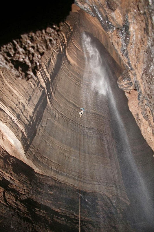
Krubera Cave, also known as Voronya Cave (Russian for “Crow’s Cave”) is the deepest known cave on Earth. It is located in the Arabika Massif, one of the largest high-mountain limestone karst massifs in the Western Caucasus region of Georgia. This mountain block contains several hundred caves that started to develop when the mountains started to rise more than 5 million years ago. Five of these caves are deeper than 1,000 meters; Krubera is 2197 meters deep and is the only known cave on Earth deeper than 2,000 meters.

Krubera Cave is a 16,058 meters long cave system which for most part consists of deep, vertical wells which are interconnected with passages. The cave starts high in the mountains, at an altitude of 2,256 meters, with a narrow entrance. Krubera Cave often is very narrow and had to be carved at many places to allow safe passage. At other places, the passageway is as large as subway tunnel.

krubera-cave-3

At the depth of 200 meters, the cave divides into two main branches: Non-Kuybyshevskaya (explored to the depth of 1,293 m in 2008) and Main (2,197 m deep). At the depth of 1,300 meters the cave further divides into numerous branches.

When speleologists started exploring the cave, one of the hardships they faced were flooded tunnels called "sumps." When they encounter a sump, cavers have to put on scuba gear and charge ahead. One of the sumps – the deepest one - has been dived up to 52 m depth.

The cave now is very popular destination for the expeditions coming from many countries.

krubera-cave-2
krubera-cave-4
krubera-cave-5
krubera-cave-6
krubera-cave-7
krubera-cave-8
krubera-cave-9
krubera-cave-10
krubera-cave-11
krubera-cave-12
krubera-cave-13
krubera-cave-1

Source: Wondermodo / Wikipedia. Photo courtesy: Avaxnews
Previous
Editor's Choice