Show Mobile Navigation
Powered by Blogger.
America
Showing posts with label America. Show all posts

Friday, October 24, 2014

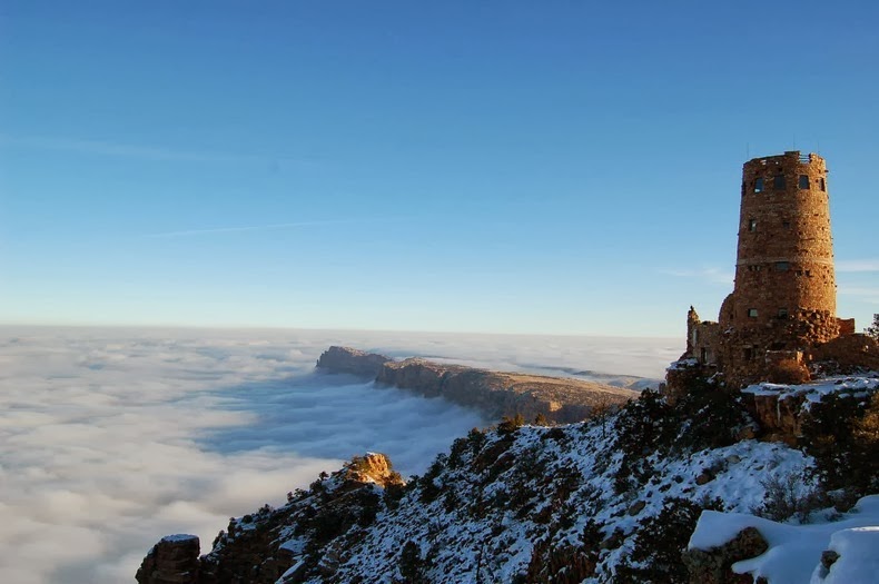
Rare Weather Phenomenon Creates River of Clouds Over Grand Canyon

XPlanet - 10/24/2014 08:48:00 PM
A rare weather phenomenon that affects the area only about once a decade, filled the Grand Canyon in the U.S. with a dense, white fog at the end of November. The phenomenon, known as "temperature inversion," happens when the temperature profile of the atmosphere is inverted from its usual state, and cooler air is trapped at the earth's surface by warmer air above.

Typically, the temperature of air in the atmosphere falls the higher up in altitude you go. This is because most of the suns energy is converted into heat at the ground, which in turn warms the air at the surface. The warm air rises in the atmosphere, where it expands and cools. When temperature inversion occurs, the temperature of air actually increases with height. The warm air above cooler air acts like a lid, trapping the cooler air and fog at the surface and preventing it from rising.

grand-canyon-fog-1

Temperature inversions happen once or twice a year, typically in the winter months. However, these inversions are partial and cover only few parts of the Grand Canyon. The most recent inversion happens only once every 10 years, because the fog filled up the entire canyon and it happened on a cloudless day.

AccuWeather.com Meteorologist Andy Mussoline explained the factors that contributed to the event.
"First, there was higher-than-normal moisture in the canyon," he said. "There was 0.75 of an inch of liquid precipitation that fell between Nov. 20 and Nov. 24 at the Grand Canyon National Park Airport [both snow and rain]. Normal precipitation during that time is only 0.19 of an inch, which converts to nearly 400 percent of normal precipitation within about a week of the event."

“Additionally, the average high temperature for this time of year is about 48 degrees Fahrenheit, which means there would be less evaporation of that precipitation than there would be in the summer months. This allowed more moisture to stay in the air inside the canyon.”

"A high pressure system settled into the region late last week and allowed for clear skies and calm winds, two important weather conditions that allow the air near the ground to cool rapidly," Mussoline said. "The rapid cooling of the ground allowed a temperature inversion to form."

grand-canyon-fog-2
grand-canyon-fog-3
grand-canyon-fog-4
grand-canyon-fog-5
grand-canyon-fog-6
grand-canyon-fog-7

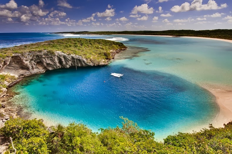
Dean's Blue Hole, World's Deepest Blue Hole

XPlanet - 10/24/2014 08:46:00 PM
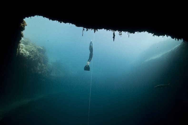
Dean's Blue Hole near Clarence Town on Long Island, Bahamas, is the world's deepest known “blue hole” - a term given to any deep, water filled, vertical caves or sinkholes with an entrance below the water surface. While most blue holes and sinkholes reach a maximum depth of 110 meters, Dean's Blue Hole plunges to more than 200 meters, which makes it quite exceptional. At the surface, Dean's Blue Hole is roughly circular, with a diameter ranging from 25 to 35 meters. After descending 20 meters, the hole widens considerably into a cavern with a diameter of 100 meters.

deans-blue-hole-9

Blue holes are so called for the dramatic contrast between the dark blue, deep waters of their depths and the lighter blue of the shallows around them. The intense blue color is created by high transparency of water and bright white carbonate sand. Blue light is the most enduring part of the spectrum; other parts of the spectrum - red, yellow, and green - are absorbed during their path through water, blue light manages to reach the white sand and return upon reflection.

Blue holes formed during past ice ages, when sea level was as much as 100–120 meters lower than at present. These holes were formed by deeper groundwater gradually dissolving the limestone until the ceiling of these voids collapsed. Later the sea level rose and filled the holes with water.
Dean's Blue Hole is a popular spot for diving ad snorkeling. At the 2012 freediving world cup in the Bahamas, New Zealand competitor William Trubridge set a world record when he dived to a depth of 121 meters without air in Dean’s Blue Hole.

deans-blue-hole-8
deans-blue-hole-3
deans-blue-hole-4
deans-blue-hole-1
deans-blue-hole-2
deans-blue-hole-6
deans-blue-hole-7
deans-blue-hole-5

Bristlecone Pines – The Oldest Trees on Earth

XPlanet - 10/24/2014 08:28:00 PM
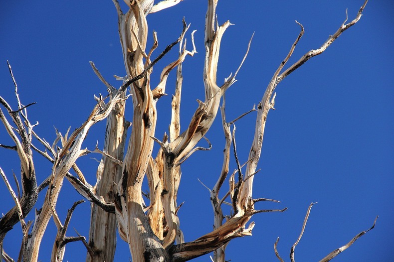
The Great Basin Bristlecone Pines, or Pinus longaeva, is a long-living species of tree found in the higher mountains of the southwest United States. Bristlecone pines grow in isolated groves in the arid mountain regions of six western states of America, but the oldest are found in the Ancient Bristlecone Pine Forest in the White Mountains of California. These trees have a remarkable ability to survive in extremely harsh and challenging environment. In fact, they are believed to be the some of oldest living organisms in the world, with lifespans in excess of 5,000 years.

Bristlecone pines grow just below the tree line, between 5,000 and 10,000 feet of elevation. At these great heights, the wind blows almost constantly and the temperatures can dip to well below zero. The soil is dry receiving less than a foot of rainfall a year. Because of these extreme conditions, the trees grow very slowly, and in some years don't even add a ring of growth. Even the tree's needles, which grow in bunches of five, can remain green for forty years.

bristlecone-pines-4

Pinus longaeva’s wood is very dense and resinous, and thus resistant to invasion by insects, fungi, and other potential pests. The wood's extreme durability plays a big part in the tree’s longevity. While other species of trees that grow nearby suffer rot, bare bristlecone pines can endure, even after death, often still standing on their roots, for many centuries. Rather than rot, exposed wood, on living and dead trees, erodes like stone due to wind, rain, and freezing, which creates unusual forms and shapes. The ancient warped and twisted bristlecone pine trees draw huge number of photographers, painters and other artists.

The oldest Pinus longaeva was discovered growing in the White Mountains of eastern California. The tree is an astounding 5,062 years old, as of 2012, and still living. Another specimen nicknamed "Methuselah", also located in the White Mountains near Bishop, is 4,843 years old (as of 2012). The exact location of both trees are kept secret to prevent tourists and hikers from damaging the trees. Previously, a 4,862-year old Bristlecone pine nicknamed "Prometheus", was cut down shortly after it was discovered in 1964 by a geology graduate searching for evidence of Ice Age glaciers.
Bristlecone pines are now protected in a number of areas owned by the United States federal government, such as the Ancient Bristlecone Pine Forest in the White Mountains of California and the Great Basin National Park in Nevada.

bristlecone-pines-3
bristlecone-pines-6
bristlecone-pines-7
bristlecone-pines-8
bristlecone-pines-9
bristlecone-pines-11
bristlecone-pines-1
bristlecone-pines-2

The Mysterious Sailing Stones of Racetrack Playa

Unknown - 10/24/2014 06:08:00 PM
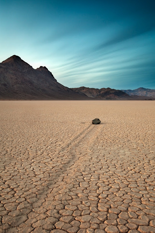
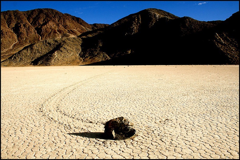
The Racetrack Playa is an exceptionally flat and dry lakebed located above the northwestern side of Death Valley, in Death Valley National Park, California. The playa is best known for one of the most strangest mysteries of the planet – the sliding rocks. These rocks can be found on the floor of the playa with long trails behind them. Although no one has actually seen the rocks move, the long meandering tracks left behind in the mud surface of the playa attest to their activity. Some of these rocks weigh several hundred pounds and have traveled as far as 1,500 feet, which leaves us with the question: "How do they move?"

The stones move only every two or three years and most tracks develop over three or four years. Stones with rough bottoms leave straight striated tracks while those with smooth bottoms wander. Stones sometimes turn over, exposing another edge to the ground and leaving a different track in the stone's wake.

Trails differ in both direction and length. Rocks that start next to each other may travel parallel for a time, before one abruptly changes direction to the left, right, or even back the direction it came from. Trail length also varies – two similarly sized and shaped rocks may travel uniformly, then one could move ahead or stop in its track.

sailing-stones-death-valley-3

Despite a century of scientific investigation, this curious phenomenon has confounded the geological community and park visitors alike. To this day, no one has ever seen the rocks move. But in lieu of eyewitnesses, countless theories have been put forward over the years in an effort to explain the reasons behind the migrations.

One early suggestion was that the rocks were driven by gravity, sliding down a gradual slope over a long period of time. But this theory was discounted when it was revealed that the northern end of the playa is actually several centimeters higher than the southern end and that most of the rocks were in fact traveling uphill.

Though no one has yet been able to conclusively identify just what makes the rocks move, one woman is coming closer to solving the mystery. For the past ten years, Dr. Paula Messina, professor of geology at San Jose State University in California, has been tracking the movement of each of the 162 rocks scattered over the playa. Her research suggest that a rare combination of rain and wind conditions enable the rocks to move. A rain of about 1/2 inch, will wet the surface of the playa, providing a firm but extremely slippery surface. Strong winds of 50 mph or more, may skid the large boulders along the slick mud. At an elevation of 3,700 feet, strong winds can rake the playa at 70 miles per hour. But even small gust of wind may move the rocks.

Some people have suggested attaching radio transmitters to the rocks or erecting cameras to catch them “in the act” in order to put an end to the speculation. But as Death Valley National Park is 95 percent designated wilderness, all research in the park must be noninvasive. It is forbidden to erect any permanent structures or instrumentation. Further, no one is permitted on the playa when it is wet because each footprint would leave an indelible scar.

sailing-stones-death-valley-1
sailing-stones-death-valley-2
sailing-stones-death-valley-4
sailing-stones-death-valley-5
sailing-stones-death-valley-6
sailing-stones-death-valley-7
sailing-stones-death-valley-8

Sources: 1234

Spotted Lake, Canada

Unknown - 10/24/2014 05:32:00 PM
Located near the city of Osoyoos in British Columbia, Canada’s Spotted Lake draws visitors from around the world. The Spotted Lake has a very highly concentration of numerous different minerals such as magnesium sulfate, calcium and sodium sulphates. It also contains extremely high concentrations of eight other minerals as well as some small doses of four others such as silver and titanium.

Most of the water in the lake evaporates over the summer, leaving behind large “spots” of minerals. Depending on the mineral composition left behind, the spots will be of white, pale yellow, green or blue in color. The spots are made mainly of magnesium sulfate, which crystallizes in the summer to form harden natural “walkways” around and between the spots.

During the First World War, minerals from the lake were harvested for manufacture of ammunition. Chinese laborers were said to have skimmed up to a ton a day of salts from the surface of the lake and shipped them to munitions factories in eastern Canada.

spotted-lake-1

Known as Kliluk to the natives of the Okanagan Valley, the lake is a sacred and culturally significant site whose potential for commercial exploitation recently generated much controversy. The therapeutic quality of the waters has been known for millennia - the Native Indians used the mud and waters of the lake to heal aches and ailments. According to a story, once two warring tribes signed a truce where both parties were allowed to tend to their wounded in the Spotted Lake,

The lake was originally owned by the Ernest Smith Family for about 40 years. In 1979, when Smith attempted to have a spa at the lake, the natives attempted to buy the lake so they could keep it as a sacred site. After over 20 years of trying but failing to convince Smith to sell the land, they finally did make a deal in late October 2001, when they bought 22 hectares of land for a total of $720,000. The First Nations paid $150,000 while the Indian Affairs Department paid the remainder.

Today, the lake is surrounded by a fence to keep people off, but you can get a good view of it from the highway.

spotted-lake-2
spotted-lake-6
spotted-lake-7
spotted-lake-8
spotted-lake-9

Sources: 12
Previous
Editor's Choice